Python coded IDOCRIW-MAUT model offers reliability in groundwater threat assessment
Published:
Description
Published work - Geosystems and Geoenvironment (2026). Link
Highlights
- Groundwater vulnerability is vital for managing high-quality water resources in the study regions.
- Combining datasets optimizes factor appraisal for groundwater vulnerability mapping.
- Determining high-risk sites for groundwater contamination
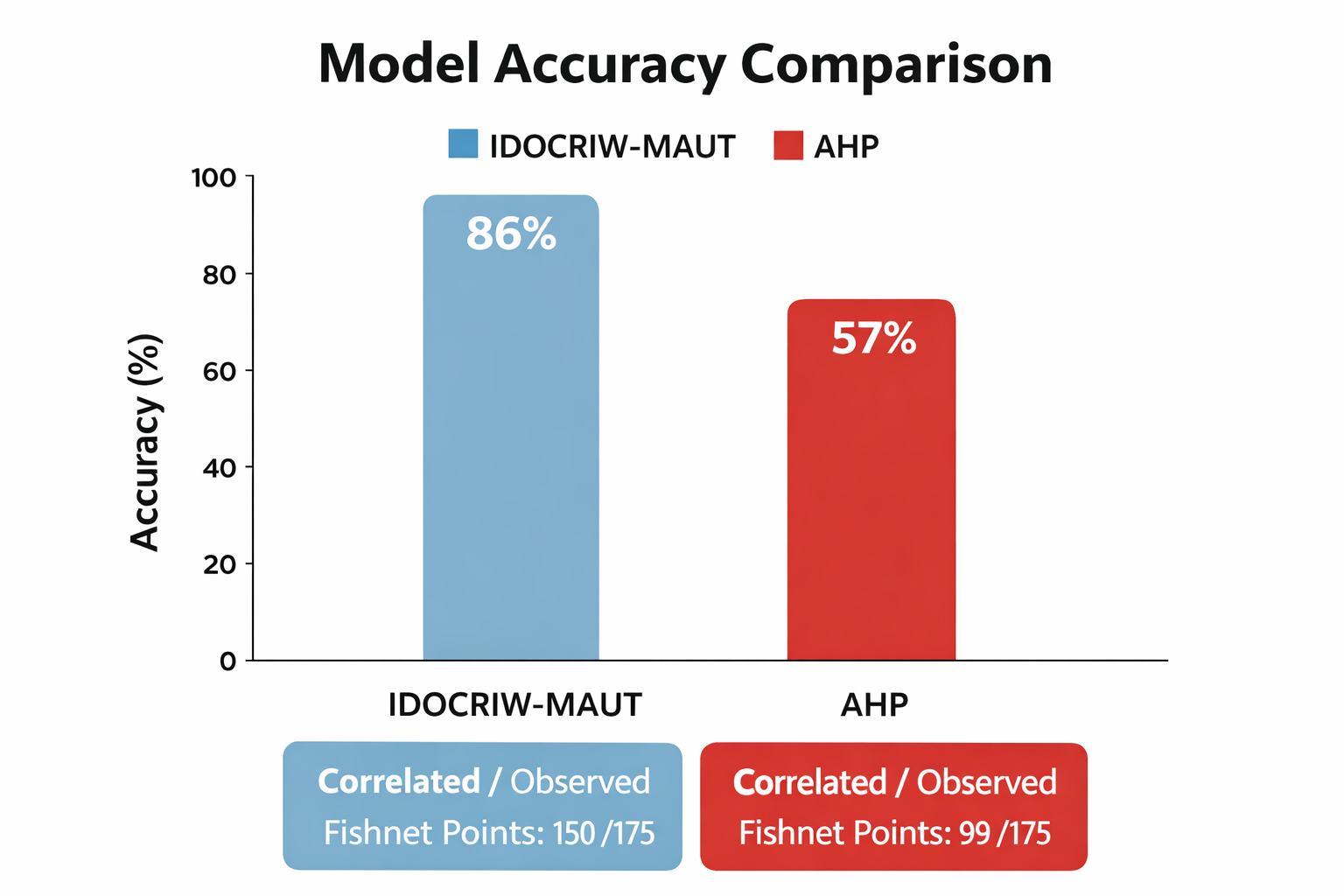
- Correlation analysis shows the IDOCRIW-MAUT model exceeds the AHP in accuracy for zoning vulnerability.
- The findings can help to generate guidance for vulnerability initiatives in the zones of impact.
Abstract
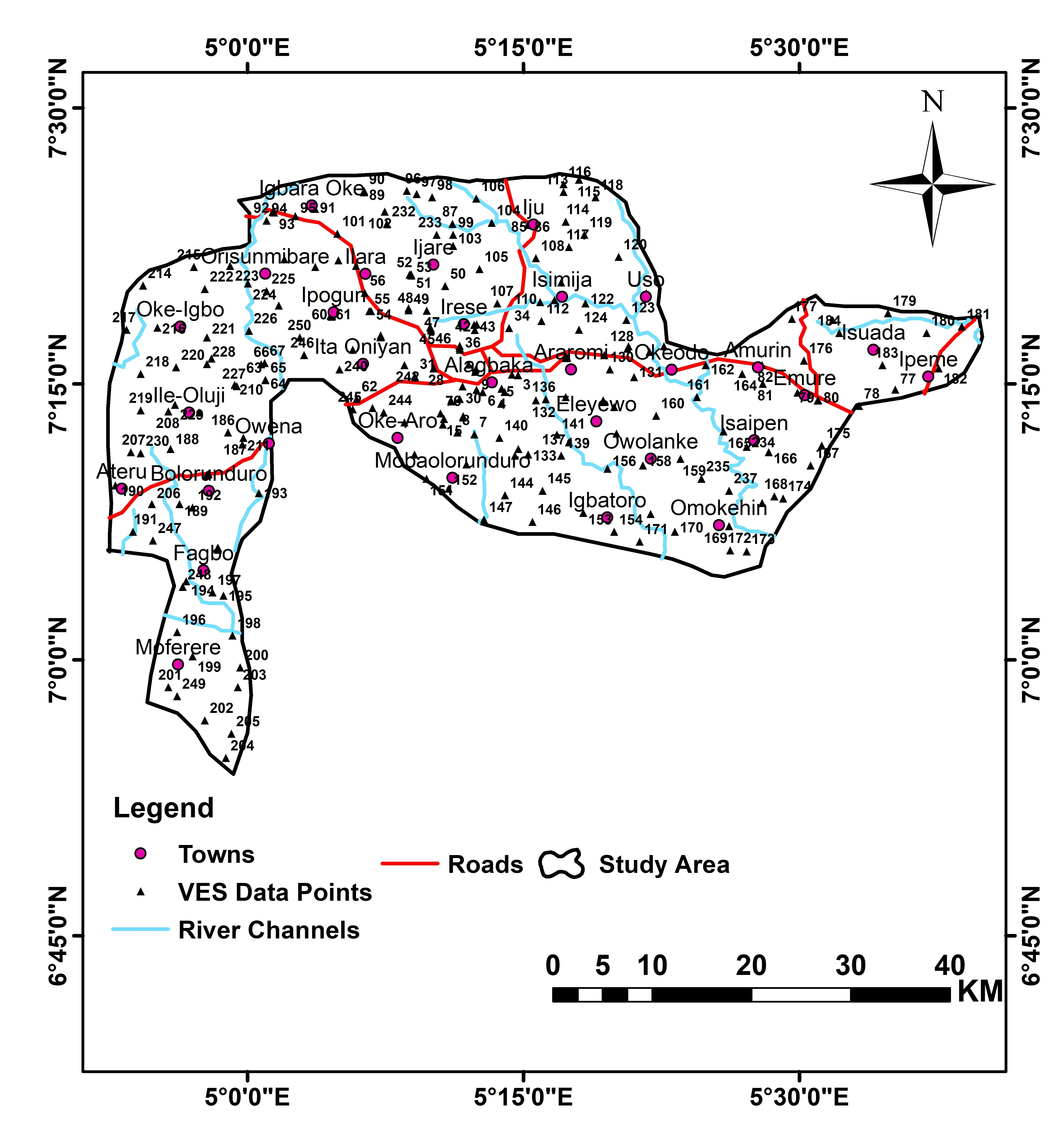
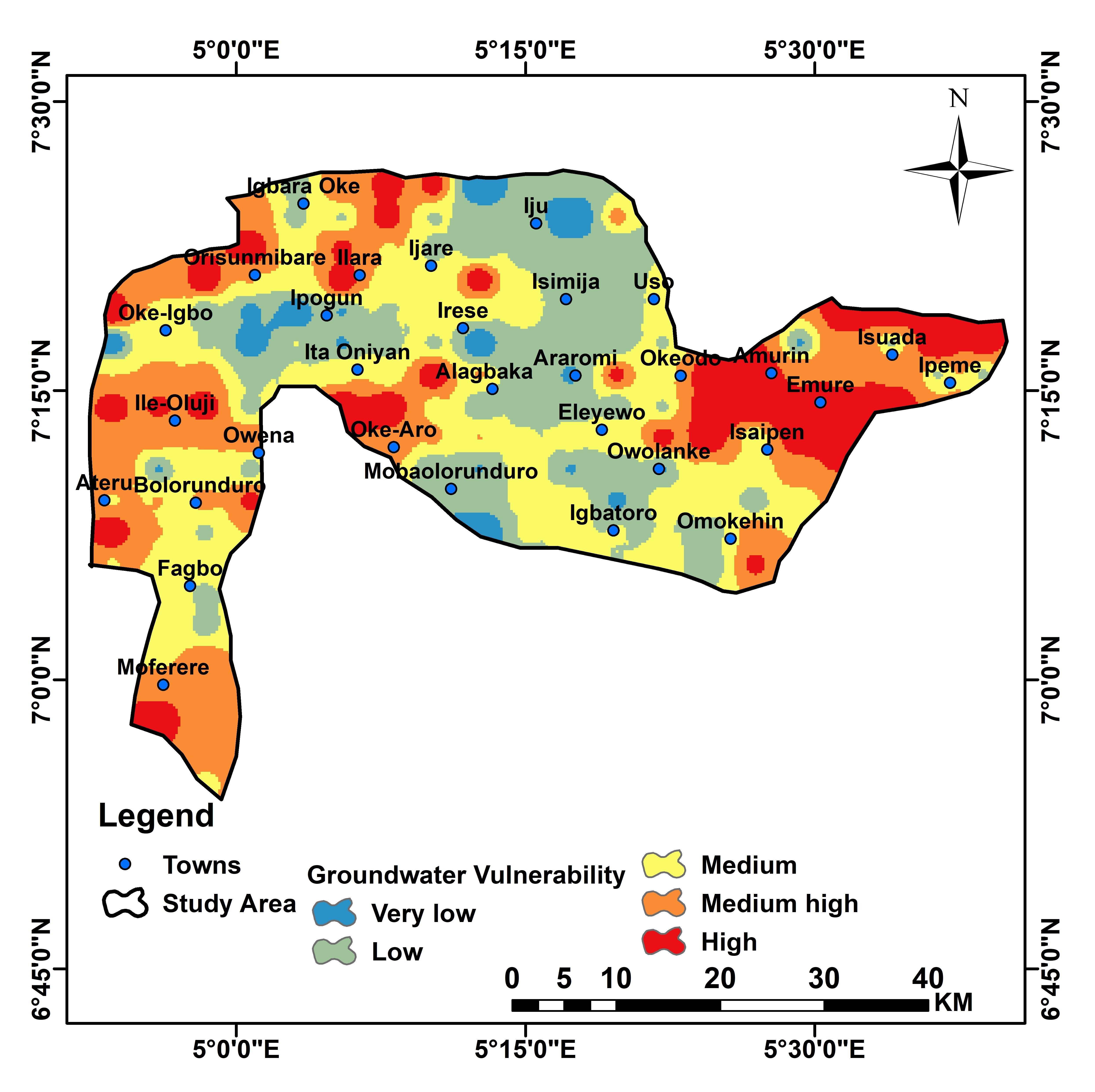
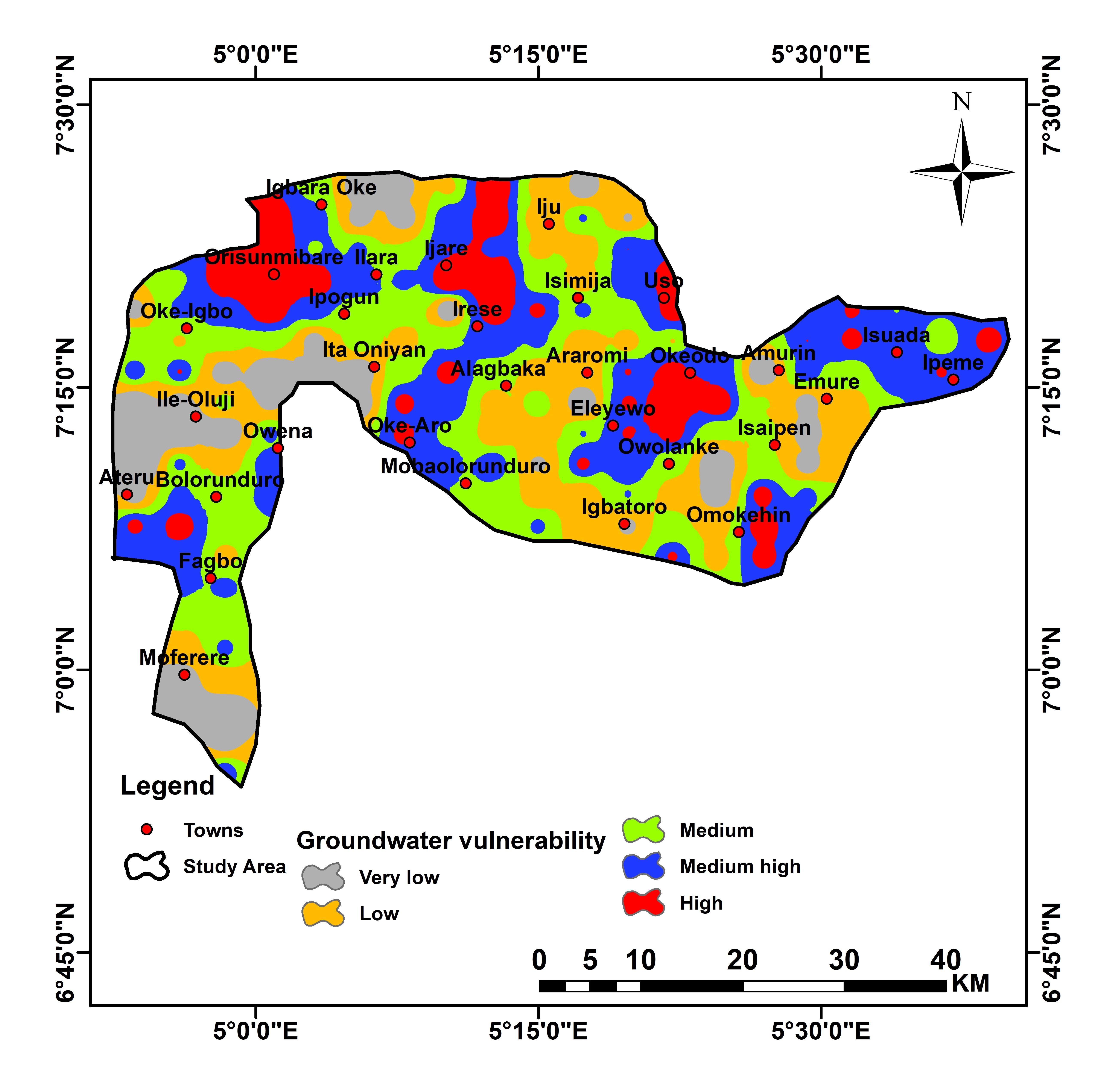
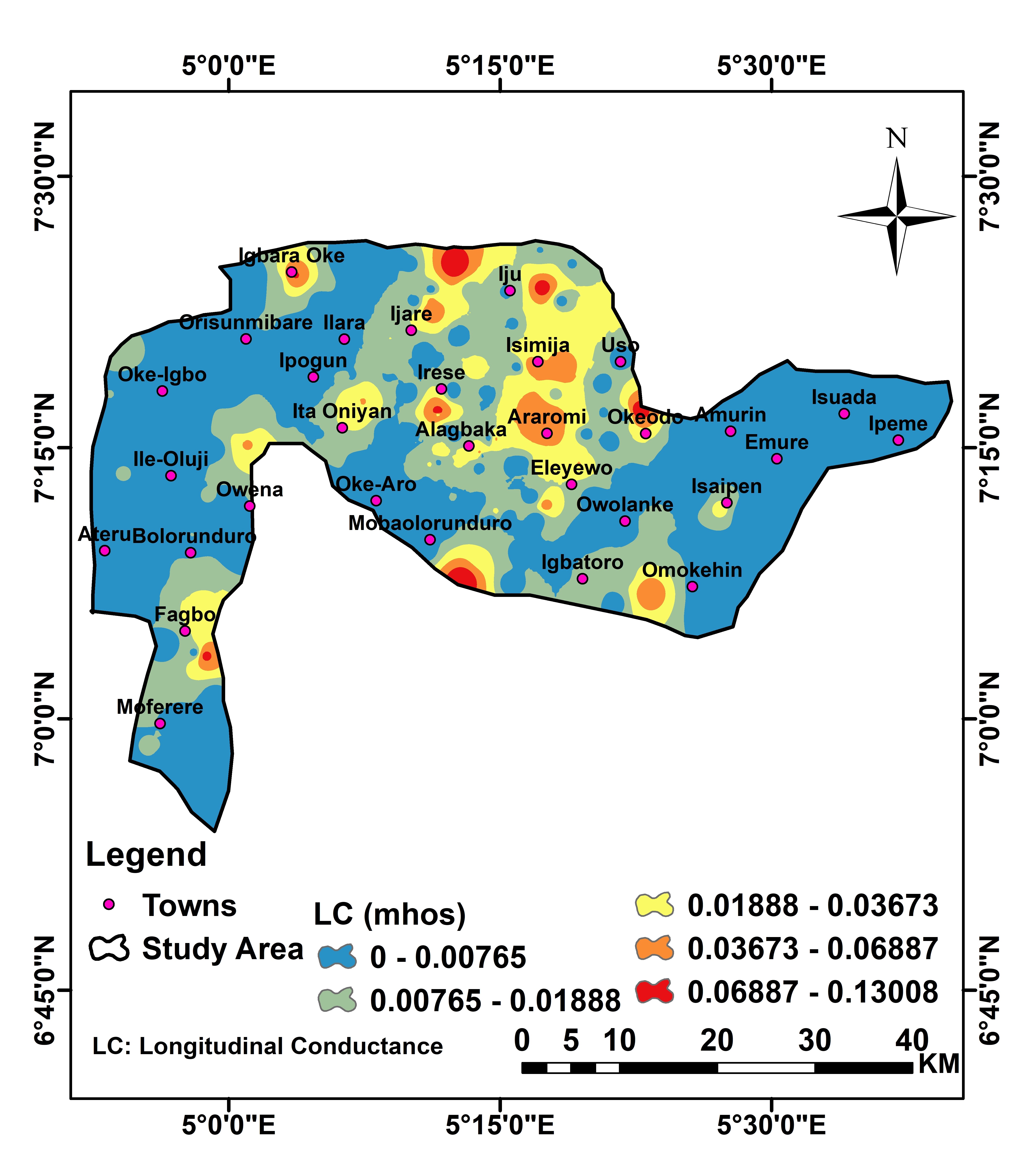
Groundwater is a valuable asset for household, farming, and commercial functions and for its ecological benefits. Notwithstanding this, this asset faces a severe threat because of increased contamination from human interference. To guarantee its dependability for current and future usage, groundwater must be managed effectively not solely in regard to availability but also quality. The current study used a recently created Python programming-based objective modelling algorithm, the integrated determination of objective criteria weights-multi-attribute utility theory (IDOCIRW-MAUT) modelling algorithm, in evaluating groundwater vulnerability located in the northern section of Ondo State, southwestern Nigeria. The evaluation outputs were contrasted to those established using the analytical hierarchy process (AHP) model. For this evaluation, five groundwater vulnerability modelling factors (GWVBMFs)—bedrock topography, hydraulic conductivity, aquifer depth, drainage density, and slope from geophysical and remote sensing datasets—were weighted applying the IDOCRIW algorithm prior to the ultimate groundwater vulnerability metrics being established by incorporating the weights into the MAUT modelling algorithm. The overall groundwater vulnerability map was created in a GIS context with groundwater vulnerability indices generated by the Python-based IDOCRIW-MAUT modelling program. The groundwater vulnerability evaluation map categorized the research terrain into five kinds: very low, low, medium, medium high, and high groundwater vulnerability, with 3% (59 km²), 26% (485 km²), 33% (608 km²), 25% (473 km²), and 13% (251 km²) falling into each category, respectively. The correlation between the IDOCRIW-MAUT model and the AHP model leveraging longitudinal conductance (LC) data was determined to be 86% and 57%, respectively. The model thus has the ability to highlight groundwater risk regions within the study area and places with similar geologic settings.
Methodology
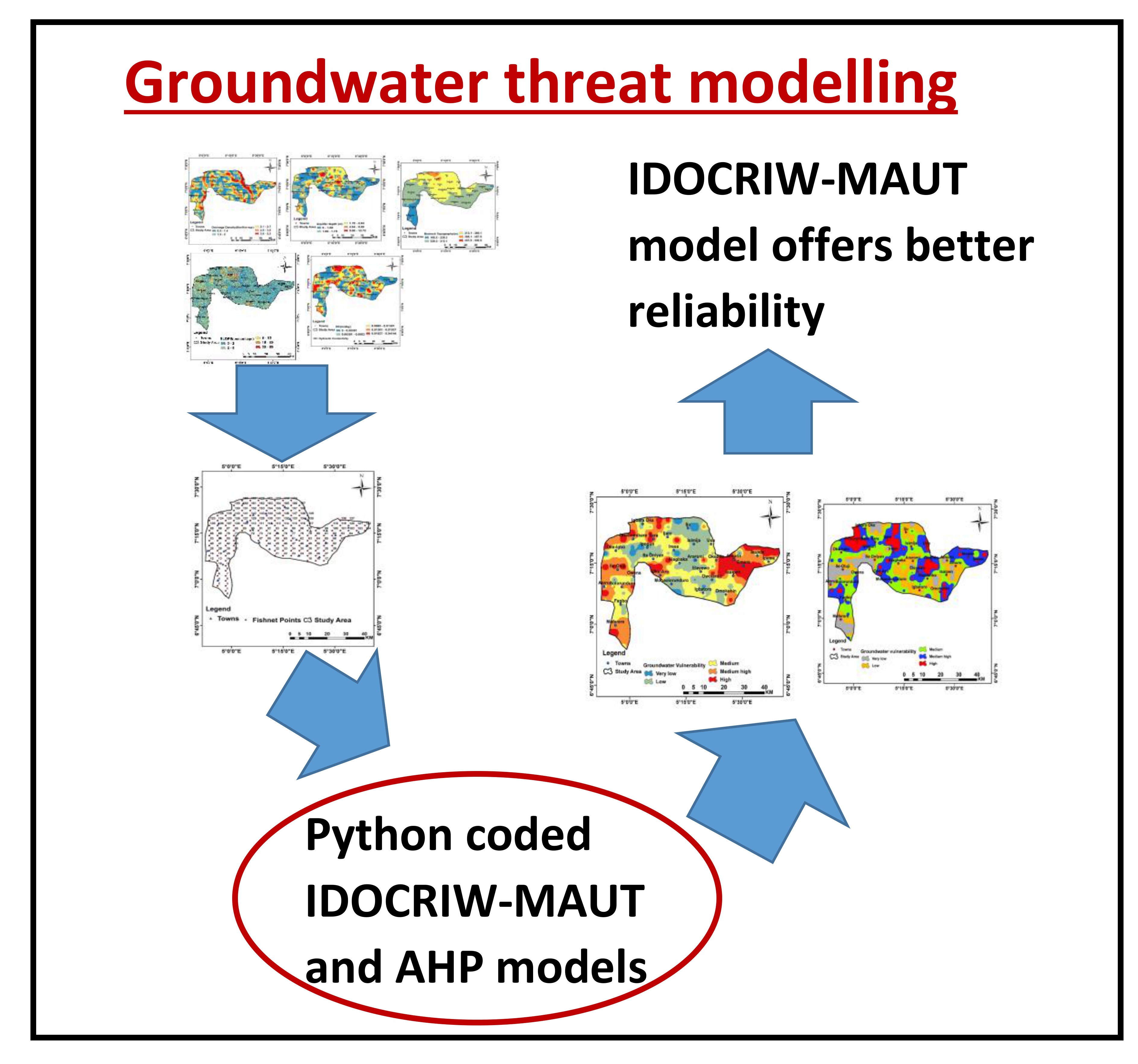
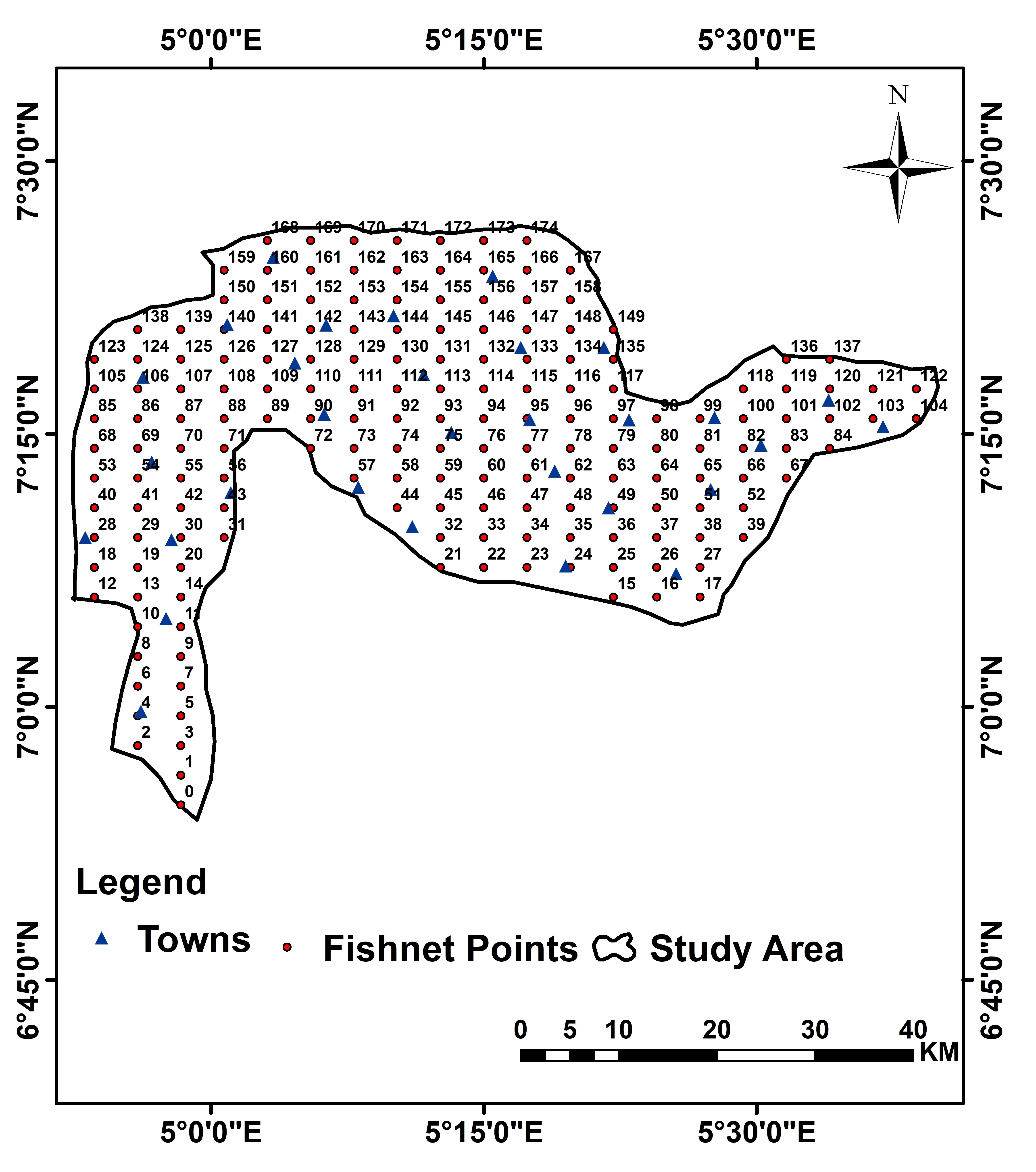
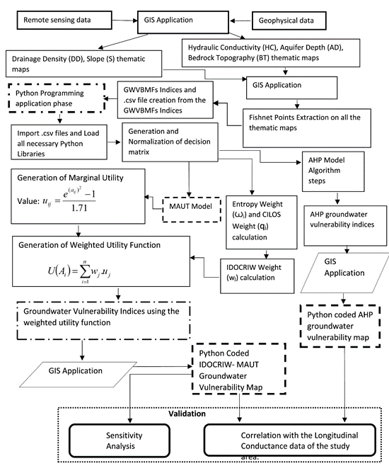
Python programming coded IDOCRIW-MAUT model was applied to groundwater threat modelling factors sourced from remote sensing (RS) and geophysical datasets. AHP model have been utilized to benchmark the reliability of the adopted approach. Decision matrix involving the pixel values of the factors was employed into the algorithm processe of IDCORIW-MAUT and AHP models to produce the vulnerability indices at the fishnet locations. GIS software (ArcGIS 10.7) software was used to produce the vulnerability maps based on the models. Correlation with longitudinal conductance data have ascertained the better predictive ability of IDOCRIW-MAUT model for groundwater threat assessment relative to AHP model.
Findings
The vulnerability models elaborate the anthropogenic threat partitioning of the study area
IDOCRIW-MAUT showed better correlation with the longitudinal conductance data of the study area relative to the AHP model
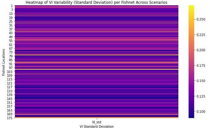
Stability of IDOCRIW-MAUT model offers inference into its better threat modelling ability than AHP model