MCDM models are advantageous in spatial modelling of landfill suitability
Published:
Description
Published work - Discover Applied Sciences (2026). Link
Highlights
- MCDM approaches are beneficial for spatial modelling of landfill suitability .
- Integration of geophysical (VES) and remote sensing datasets proved efficient as inputs for spatial modelling
- Entropy and GRA models showed higher predictive power compared to AHP model
Abstract
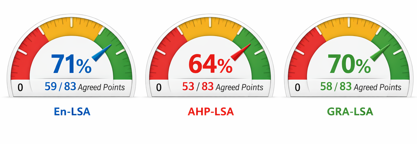
Rapid growth in solid waste generation has increased the demand for scientifically grounded landfill siting, particularly in basement complex regions where subsurface conditions strongly influence environmental safety. This study develops a geospatial multicriteria decision analysis framework to model landfill suitability within the southwestern basement complex of Nigeria. Landfill suitability assessment factors sourced from geophysical and remote sensing datasets were input into the algorithms of three weighting models (Entropy, Analytical Hierarchy Process, and Grey Relational Analysis). This approach was applied to contrast the differing computational processes of generating landfill suitability assessment maps using GIS. The Entropy model classified 65% (288 m²), 32% (153 m²) and 9% (43 m²) of the area as low, moderate, and highly suitable, respectively. The AHP model yielded 35% (169 m²) low, 49% (238 m²) moderate, and 16% (77 m²) high suitability, while GRA classified 38% (185 m²), 47% (228 m²), and 15% (71 m²) into the same categories. Proxy validation using longitudinal conductance showed accuracies of 71%, 64%, and 70% for Entropy, AHP, and GRA, confirming the superior performance of the data-driven Entropy and GRA models over the expert-based AHP approach. Reliability of landfill suitability mapping in basement terrains can therefore be enhanced through integrated geophysical and remote-sensing criteria, leveraging objective MCDM models. The study thus provides a robust, transferable framework to support environmentally safe landfill siting and informs sustainable waste-management policy in data-scarce regions.
Methodology
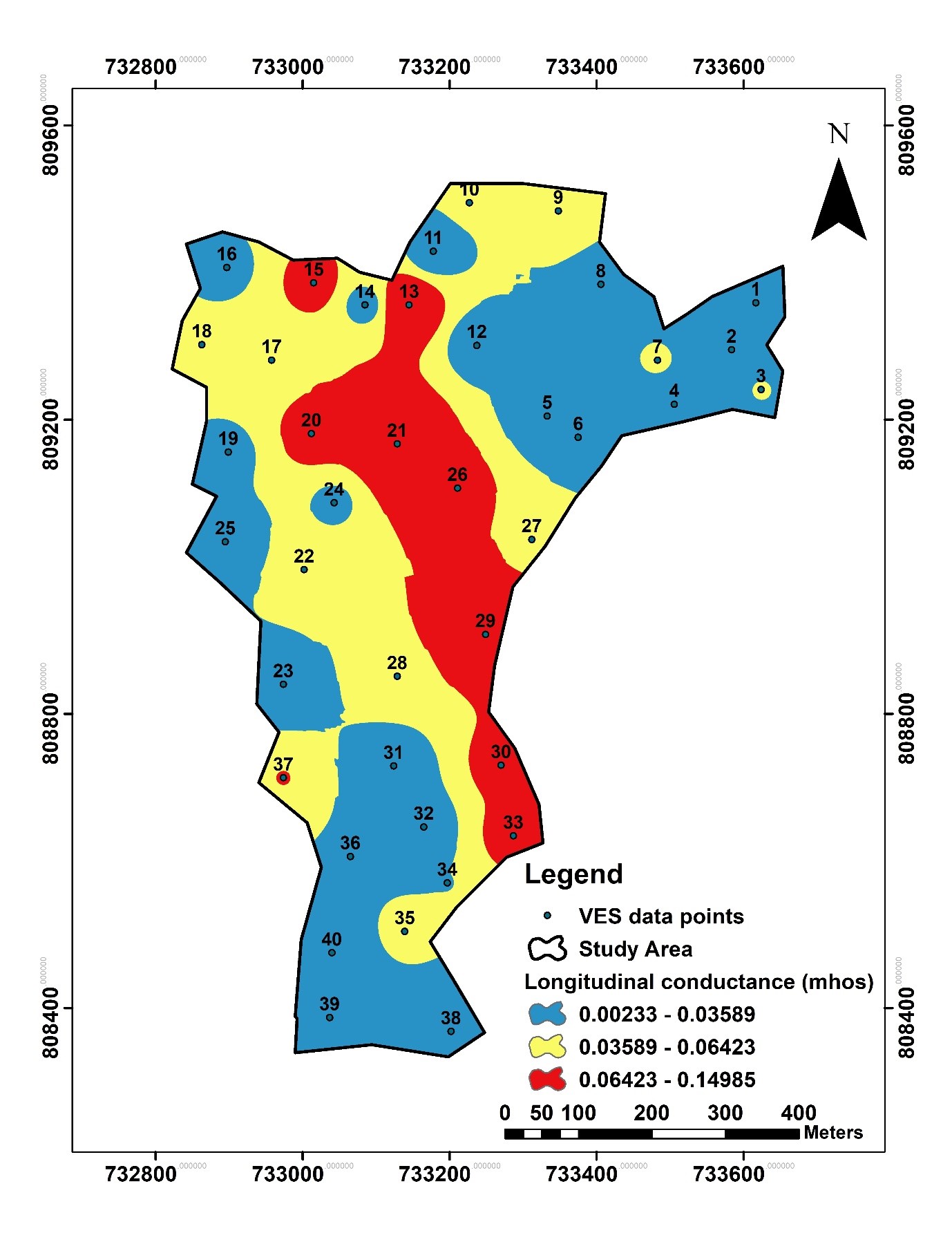
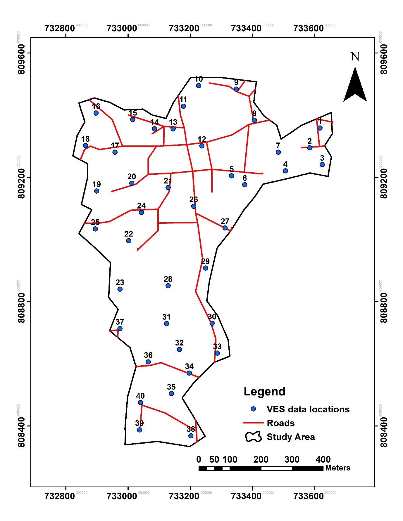
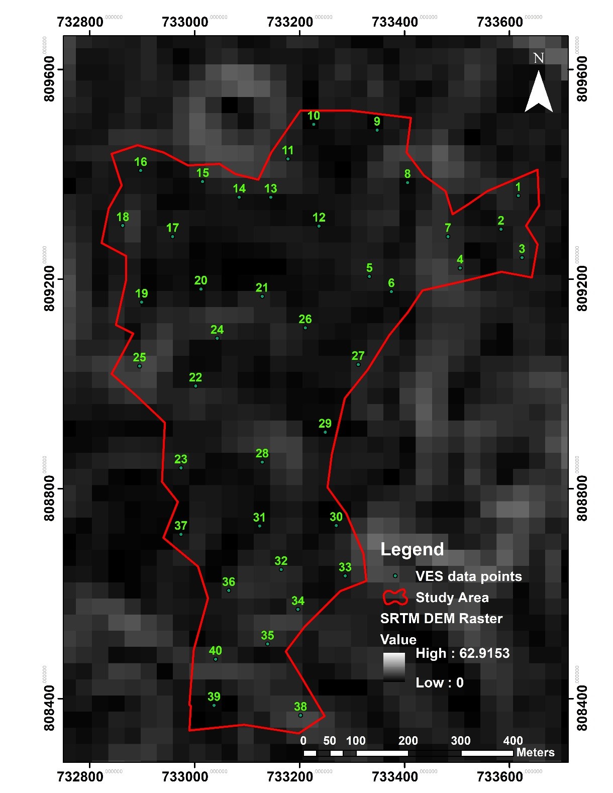
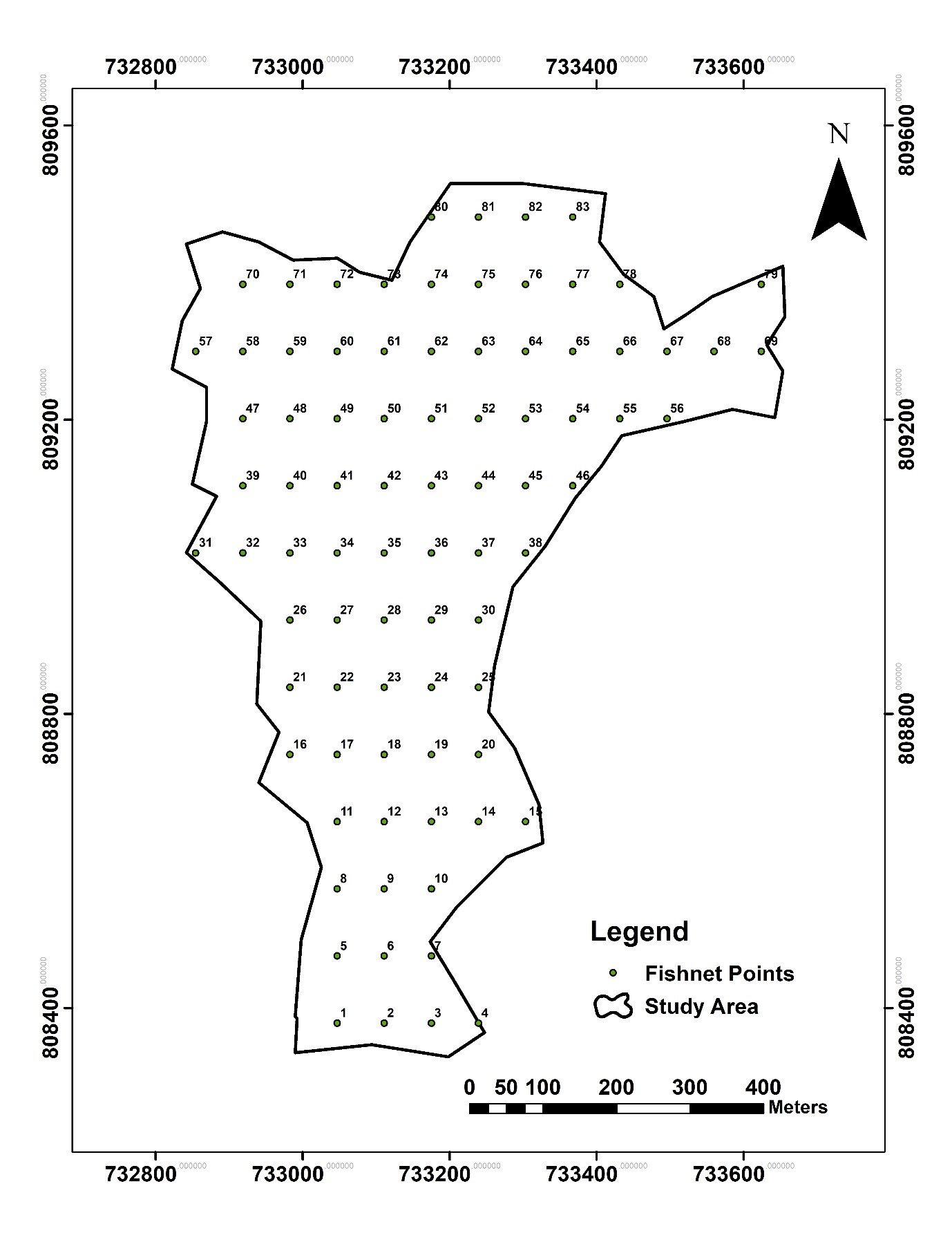
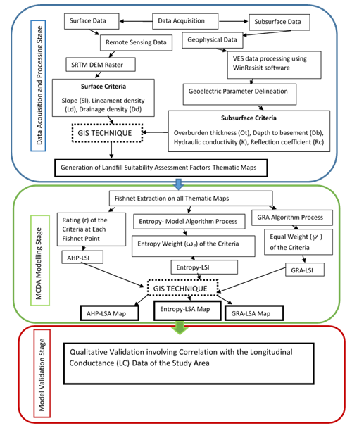
Grey relational analysis (GRA), Entropy and AHP models have been applied to model landfill suitability employing factors sourced from remote sensing and geophysical datasets. Decision matrix input to the modelling process was generated employing fishnet approach on the factors map to have sufficient modelling data. Proxy validation involving longitudinal conductance data of the study area was employed to reliably check the suitability assessment abilities of the models.
Findings
Geospatial modelling of the landfill suitability was highlighted by Entropy, GRA and AHP models
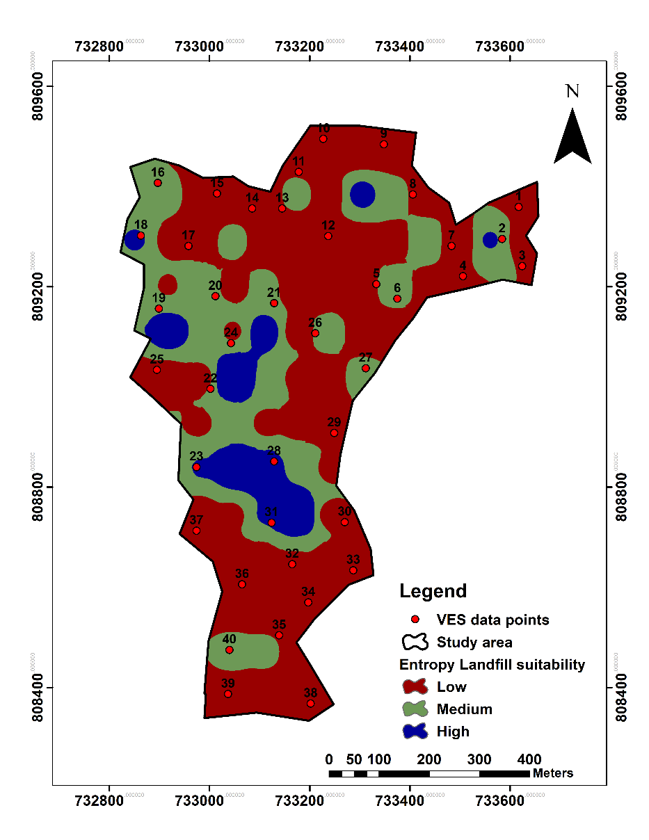
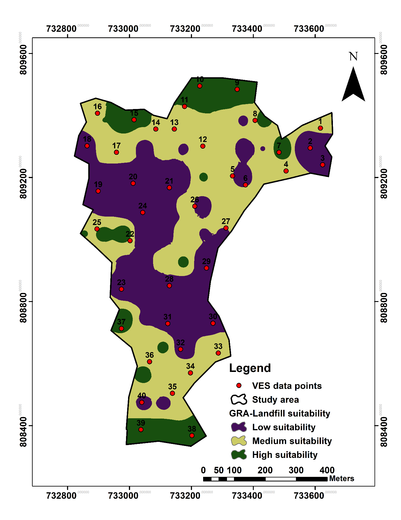
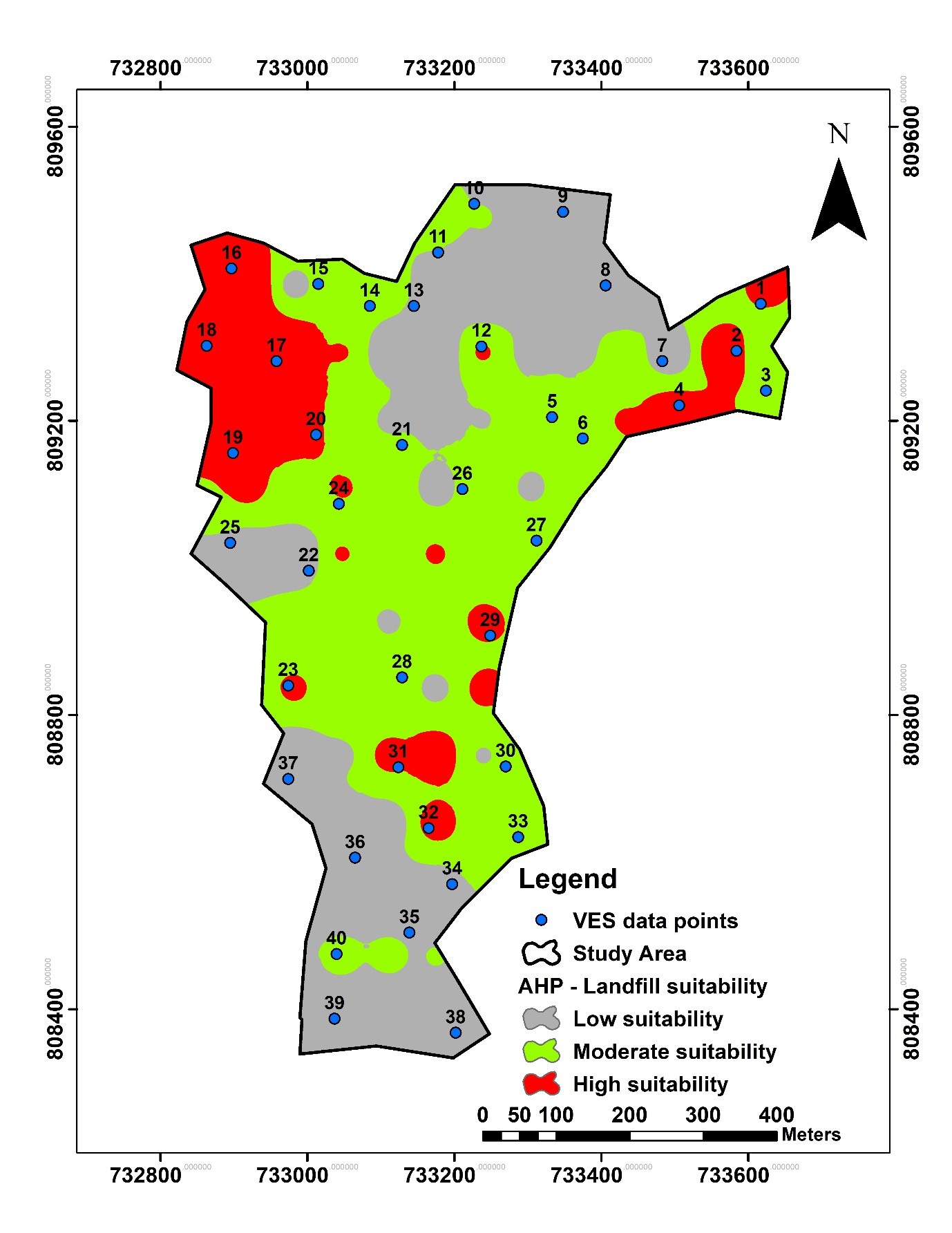
Entropy and GRA models enhance the geospatial modelling of landfill suitability in the study area than the AHP model